I predict that in the future, Google (or whatever its parent company is called in the year 2525) will sell the entire Gmail database as a source to be mined for historical data. This will of course raise a host of issues concerning privacy, but as long as the search is restricted to a point […]

I am currently experiencing a higher than usual volume of student papers. I will grade your paper in the order in which it was received. Your paper grade is very important to me. You can’t always be experiencing a higher that usual volume…. Yes, I can.

I believe it was the great Robert Frost, the college history professor who wrote: The pillows are lovely, dark and deep,But I have promises to keep, And essays to read before I sleep, And essays to read before I sleep

On December 9th, I’ll be speaking (in Dutch) about slavery in New York at the Pelgrimvaderskerk (Pilgrim Father’s Church) in Rotterdam/ Delfshaven, the Netherlands. This is the church where the Pilgrims last held service before leaving the Netherlands and voyaging to what became Massachusetts.

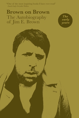
Jim E. Brown’s new autobiographical memoir, Brown on Brown: The Autobiography of Jim E. Brown; Vol 1: The Early Years (2021), is most definitely a book, in the sense that it contains the minimum number of pages required to be considered such, forty-eight. There is a lot of white space on these pages. One must […]
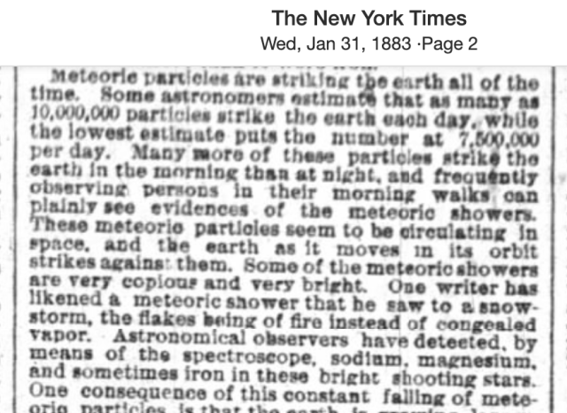
For a book I’m writing, I’ve spent an awful lot of time in the year 1883. It was a good year, more or less, and I’m come to understand the manner of speech, the outlook of the people, and, in short, to breathe their air. As a historian once said, keep researching until you can […]

In a previous post, I presented an example of how a newspaper could provide an “illustration” without using engraved plates. In that case, it was a map of Spain made simply by typing the names of cities in such an order on the page to approximate their actual relative locations. In a 19th century history […]

by Blue, the cat. Make sure you have a writing utensil. Check if it is sharp. Look to the ceiling for inspiration. Look to the table. Now you may start your writer’s block.